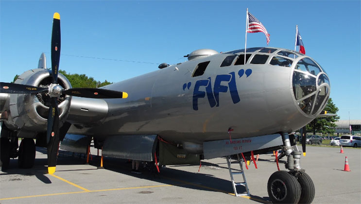
The airport is located at the former Plattsburgh Air Force Base and has been owned by Clinton County since 2002. The old base is still being redeveloped by Plattsburgh Airbase Redevelopment Corporation, established in 1995 after the airbase closed. The airport’s massive facilities have been upgraded to civilian aviation standards and the county fully transitioned here from Clinton County Airport as of June 2007.
Facilities and aircraft
Plattsburgh International Airport covers an area of 1,912 acres (774 ha) at an elevation of 234 feet (71 m) above mean sea level. It has one runway designated 17/35 with an asphalt/concrete surface measuring 11,759 by 200 feet (3,584 x 61 m).
The airport has a 35,300 square foot passenger terminal building that opened in 2007. Before 2007 the airport’s main structures were the old Strategic Air Command alert facility (aka “Mole Hole”) on the north end and the control tower and base operations building in the southeast end. The passenger facility has limited services beyond the airlines, along with a snack booth and food stand. Various former Air Force hangars are located along the tarmac, with largest being 28,000 square feet. The air traffic control tower is located separately, but is currently not functional (i.e., the airport is currently an uncontrolled airport, limited to UNICOM only).
Aircraft rescue and fire fighting is provided by the airport with a fire station utilizing the former USAF fire station adjacent to the old control tower. The department uses former military airport tenders and has a newer Rosenbauer Panther 6×6 (delivered in 2009).
For the 12-month period ending May 31, 2011, the airport had 13,436 aircraft operations, an average of 36 per day: 50% general aviation, 35% air taxi, 15% scheduled commercial, and <1% military. At that time there were 41 aircraft based at this airport: 63% single-engine, 20% multi-engine, 12% jet, and 5% helicopter.
Source: https://en.wikipedia.org/wiki/Plattsburgh_International_Airport

QUICK FACTS
Airport type
Public
Owner/Operator
Clinton County
Location
Town of Plattsburgh, NY
Elevation AMSL
234 ft / 71 m
Coordinates
44°39′03″N 073°28′05″W
Website
flyplattsburgh.com
New York Jet Charter
is a full-service jet charter company that takes pride in providing our customers with 24/7 on-demand jet charter services.
CALL US
(888) 522-0883 or
